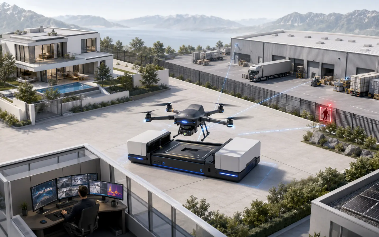
This page covers the essential concepts and links to more specialised resources. Capabilities, constraints and rules must always be checked against the relevant site and use case.
What is drone surveillance?
Drone surveillance is the use of an aerial camera, operated manually or through an automated mission, to observe a defined area and send images to an authorised operator. A surveillance drone can patrol a route, verify an alarm, inspect a difficult area and provide visible or thermal imagery. It does not decide whether someone is a threat or replace a response team. Its value depends on a lawful flight scenario, reliable integration with fixed sensors and a human who can interpret the images and act. The applicable guidance is set out in FOCA : Drone-operator registration.
A security loop, not an isolated flying object
A useful mission follows a simple loop: detect, qualify, observe, decide and document. Radar, an infrared barrier, a camera or access control triggers an alert. The system checks whether flight conditions are acceptable. The drone then travels to a predefined area while a remote pilot or monitoring centre follows the mission and can stop it. Relevant images support the agreed procedure: call the responsible person, address someone on site, dispatch security or, where facts justify it, alert the authorities.
- Scheduled patrol along an authorised route and during an authorised time window.
- Launch on alarm to obtain another viewing angle.
- Visible or thermal inspection of an inaccessible area.
- Live transmission to an authorised operator.
- Automatic return to a charging station after the mission.
A different role for each site size
At a villa, a drone may occasionally check a large plot, outbuilding or remote entrance, but neighbouring property and public space impose strong limits. At a warehouse or logistics platform, it can inspect a fence, line of trailers or roof after an alarm. On an industrial site, it adds an overview to ground sensors and may avoid exposing an officer to smoke, a suspected leak or unstable ground. The larger and more structured the perimeter, the more valuable aerial mobility may become.
For a deeper analysis, read Artificial intelligence and surveillance. What automated analytics can detect and why people remain essential.
Drone-in-a-box: the infrastructure behind repeatable missions
A drone carried in a vehicle can be useful for a planned inspection, but it is not ready the moment an alarm arrives. A drone-in-a-box system adds a permanent station that protects the aircraft, recharges its battery, checks selected parameters and enables on-site launch. This infrastructure, more than the aircraft alone, makes recurrent patrols or remote alarm verification practical.
| System | Primary fit | Operating architecture | Key point to validate |
|---|---|---|---|
| Sunflower Labs Beehive | Large properties, estates and campuses | Docked drone, ground detection and remotely supervised alarm verification | Swiss flight feasibility, privacy boundaries and service availability |
| Azur Drones Skeyetech E2 | Sensitive, industrial and critical sites | European drone-in-a-box platform for security, safety and inspection missions | Authorised operating model, control-room integration and local support |
| DJI Dock 3 | Construction, logistics and industrial sites | Dock 3 with Matrice 4D or 4TD aircraft and the DJI software ecosystem | Complete security integration, data governance and performance on the actual site |
| Percepto Air Max | Large industrial inspection and monitoring programmes | Air Max aircraft, permanent Base and AIM data-management platform | Workflow integration, permissions and the economic case beyond occasional security events |
| Autel EVO Nest | Industrial sites and prepared perimeter missions | EVO Nest, EVO Max Series aircraft and AICS | Exact generation, local support, data flows and Swiss operating feasibility |
| JOUAV VTOL Hangar | Linear infrastructure and very large territories | Automated hangar, CW-15V fixed-wing VTOL and JoCloud | BVLOS authorisation, communications, station infrastructure and support |
A station, communications and mission control
A professional installation usually combines a weather-resistant enclosure, charging, data connectivity, planning software and a monitoring console. Before launch, it can check aircraft availability, battery state, enclosure closure, local weather measurements and configured restrictions. During flight, position, technical alarms and necessary feeds are transmitted to the control centre.
- Clear take-off area protected against unauthorised access.
- Local measurements of wind, precipitation and visibility.
- Encrypted link and fallback behaviour after loss of communications.
- Geofenced routes and areas that must never be overflown.
- Technical log of flights, alarms, interventions and updates.
Automated does not mean absolutely autonomous
A route may be generated and flown automatically while an operator monitors key stages and can intervene. Automated take-off must not be confused with autonomous judgement. A system can fly to waypoints, stabilise a camera and return to its station, but it does not possess the human context needed to decide that someone is malicious, an emergency is real or a particular intervention is proportionate. The stated specifications are detailed in Nokia : Automated 5G drone-in-a-box solution.
Optical cameras, thermal imaging and navigation: select the right sensors
The drone is a carrier. Useful information comes from its sensor payload, transmission quality and image interpretation. A high-definition visible camera may distinguish a vehicle, damage or an open door when light is adequate. A thermal camera represents differences in thermal radiation. Depending on context, it can reveal a presence, heating or damp area, but it does not magically see through walls.
Optical and thermal views complement one another
Thermal imaging is particularly good at drawing attention to temperature differences in darkness. Sun-warmed ground, reflective surfaces, dense vegetation and adverse atmospheric conditions can still affect it. Optical imaging contributes the colours, textures and details needed for understanding. Robust verification alternates or combines the two instead of treating thermal imagery as independent proof.
- Wide-angle camera for general situational awareness.
- Stabilised zoom to assess detail without flying unnecessarily close.
- Thermal sensor to search for heat contrasts, especially at night.
- GNSS, inertial sensing and obstacle sensors for navigation.
- Ground lighting and fixed cameras to cover obscured areas.
AI helps triage; it does not make evidence infallible
Image analytics can flag a human shape, stopped vehicle or unusual change and show a supervisor the most relevant clips. This reduces the fatigue of watching video but still creates false alarms and misses. An animal, shadow or moving tarpaulin may trigger an alert, while a partly concealed person may go undetected. Thresholds must be calibrated on site, measured and reviewed, with human validation before any sensitive action.
Practical uses for villas, businesses and industrial sites
A drone becomes more relevant when distance, obstacles or hazardous areas are present. It can quickly cross a yard that a fixed camera sees only partly, inspect the source of a roof alarm or travel along a property boundary. In a small garden beside a road and several neighbours, correctly positioned fixed cameras are often simpler, quieter and easier to operate lawfully.
Villas and large private properties
On a large estate, an alarm-triggered launch can check a secondary gate, outbuilding or boundary without asking the owner to step outside. An occasional patrol may inspect the grounds after a storm. The design must avoid filming neighbours' gardens, nearby windows or pavements. A short route within the property, limited camera orientations and privacy masks are often more defensible than a broad aerial patrol.
Warehouses, shops and logistics platforms
At night, an alarm may concern a fence, loading bay, trailer, outside storage or vehicle row. A drone supplies a cross-site view and follows a route without requiring an officer to walk alone across the platform. It may also check standing water, an obstacle or apparent smoke. Where drivers, contractors or night teams are active, the protocol must address involved and uninvolved people, schedules, notices and no-fly areas.
Industry, energy and large perimeters
Industrial sites can combine security and technical observation: unauthorised access, damaged fencing, roofing, apparent overheating, external pipework or a temporarily dangerous zone. A drone may reduce a technician's exposure time, but it does not replace a certified measurement or specialist diagnosis. A thermal anomaly needs verification by a competent person; a detected person requires qualification by monitoring staff.
Alarm verification: turn a signal into a decision
A perimeter alarm says a condition has been met; it does not explain the whole scene. A branch, animal, late employee or intrusion can produce similar signals. Verification gathers enough evidence for a proportionate response. A drone is valuable when it supplies a missing angle, but its video must reach the same console as cameras, access-control events and site information.
From technical event to human response
Consider an illustrative warehouse scenario. At 02:18 two neighbouring sensors report a crossing near parked trailers, while a fixed camera shows only partial movement behind a vehicle. If flight is authorised and weather is suitable, the drone moves to an observation point without overflying a public road. The operator sees an unexpected van and follows the escalation procedure. This is not a reported incident and does not prove that a drone would prevent theft; it demonstrates how several layers reduce uncertainty. The applicable guidance is set out in FOCA : Rules for flying drones.
- Trigger confirmed by one or more reliable signals.
- Automatic and human checks of mission conditions.
- Observation limited to the necessary area and duration.
- Operator decision guided by an escalation matrix.
- Auditable alert without excessive image retention.
Integrate rather than multiply screens
If the pilot, guard and site owner each receive a different interface, the time advantage disappears. Integration should present one incident with location, fixed and mobile imagery, history and expected actions. It must also manage permissions: a pilot does not necessarily need all access-control data, and an owner must not repurpose the system to observe people unrelated to security.
Two real cases show the potential:and the operating framework
Documented deployments show what drones do today, but they must not be turned into universal promises: missions, permissions, responsibilities and environments differ. Two examples are particularly instructive, one in Switzerland over a disaster area and one involving first responders in the United States. The applicable guidance is set out in EASA : General questions about drones and UAS.
Blatten: monitoring a hazardous zone from a station
Following the May 2025 landslide at Blatten in Valais, the affected area required long-term monitoring. Swisscom describes an automated drone, deployed from late July 2025 in a weather-resistant station, sending visible and thermal imagery to an operations centre in Ittigen. Certified remote pilots planned and monitored the flights. The municipality wanted to detect entry into the prohibited zone and events such as emerging fires or damage to buildings that remained intact. The stated specifications are detailed in Swisscom : Nationwide Drones as a Service network with Nokia.
The case combines a precisely defined mission, exceptional perimeter, local base and remote supervision. Airspace remained demanding because helicopters were active above the site. Swisscom says the Federal Office of Civil Aviation established a temporary exclusion zone and a separate system detected private drones violating it. Aircraft automation does not remove airspace coordination; it makes that coordination even more important. The stated specifications are detailed in Swisscom : Drones operating above Blatten.
Chula Vista: earlier situational awareness for first responders
In the United States, Chula Vista launched a Drone as First Responder programme with its police department in 2018 under a Federal Aviation Administration pilot programme. A 2019 city publication reported that it had exceeded 1,000 missions. The purpose was to provide real-time video in response to calls so responders had better information before arrival. The applicable guidance is set out in City of Chula Vista : Drone as First Responder exceeds 1,000 missions.
This concerns US public safety, not private surveillance in Switzerland. It is cited to demonstrate an operating model: prepositioned aircraft, event-triggered launch and a professional using the image to prepare a response. It is neither a transferable authorisation nor a governance model to adopt without debate. Police-scale operations create especially strong requirements for proportionality, transparency and public accountability.
For a deeper analysis, read Security robots. How ground platforms work, available models and real-world applications.
VLOS, BVLOS and operating categories: why aviation law changes the design
Switzerland has applied European drone rules since 2023. They classify an operation by its risk rather than whether it is private or commercial. Professional flight does not automatically enter the specific category; conversely, an automated security flight can quickly exceed the conditions of the open category. The applicable guidance is set out in EASA : Open category for drones.
VLOS: the aircraft remains visible to the naked eye
Visual line of sight means the remote pilot keeps direct visual contact with the drone and observes surrounding airspace. Watching only the camera feed is not sufficient. In some configurations an observer beside the pilot may assist. FOCA permits night VLOS in the open category with position lights but notes that range must be reduced as visibility declines. The applicable guidance is set out in FOCA : Drone frequently asked questions.
BVLOS and the specific category: demonstrate risk control
Beyond visual line of sight is one of the operations that moves into the specific category. The operator must obtain FOCA authorisation or follow the applicable procedure where a standard scenario's conditions are met. FOCA requires an application to demonstrate safe, controlled and compliant operation, including an operations manual and emergency response plan. Depending on the scenario, the assessment may use a method such as SORA. The applicable guidance is set out in FOCA : Introduction to the specific category.
- Check the official restriction map and DABS before operating.
- Register the operator where required.
- Verify the aircraft class and remote-pilot competence.
- Hold the required third-party liability insurance.
- Document normal, emergency and maintenance procedures.
Automation, pilots and accountability
Even when a station launches a preprogrammed mission, the operation retains a chain of responsibility. The organisation is the operator, the remote pilot performs the functions set by the scenario, and the site owner remains responsible for the security purpose and commissioned data processing. FOCA states that qualifications in the specific category depend on the operation and its risk assessment. Procurement must therefore cover a compliant operating capability, not only hardware.
For a deeper analysis, read Swiss regulations. Aviation law, personal data and responsibility explained.
Privacy, data and cybersecurity: design proportionate surveillance
A camera-equipped drone can capture people from an unusual angle and see across physical property boundaries. In Switzerland, images are personal data when people are identifiable, so the Federal Act on Data Protection applies. The FDPIC states that private individuals should in principle limit filming to their own property: neighbouring land and public space should not be included. The applicable guidance is set out in FDPIC : Video surveillance by private individuals and FDPIC : Private video surveillance of public space.
Minimise collection by design
Record only what is needed for a clearly stated purpose. Measures may include geofences, flight corridors within the site, camera-orientation limits, privacy masks, suitable resolution and event-triggered rather than continuous capture. Retention should match a real need; an uneventful clip should not become a permanent archive.
Where law and context require it, people who may be filmed should receive transparent information, including employees, contractors, residents and visitors. Workplace monitoring is subject to additional rules and must not become permanent observation of employee behaviour. Sensitive uses require context-specific legal analysis.
- Written purpose and identified justification.
- Routes and angles limited to the necessary perimeter.
- Image access restricted to authorised roles.
- Short retention and verifiable deletion.
- Logging of viewing, export and configuration changes.
Protect the drone against compromise
The aircraft, station, operator account, mobile network and console form one digital chain. A weakness can expose video, enable takeover or make the mission unavailable. Cover strong authentication, encryption, certificates, network segmentation, update management, component inventory and access revocation. Cloud-hosted data deserves the same care as data stored on site.
For a deeper analysis, read Robotic security: complete guide. Design protection that coordinates detection, robots, drones and intervention.
Weather, battery life and obstacles: design around the limitations
A drone is not a fixed camera moved into the sky. Battery endurance is limited, stability depends on wind and availability varies with rain, cold, heat, fog, ice and battery condition. A protected station improves resilience but cannot make the aircraft suitable for every condition. Manufacturer limits, authorisation conditions and internal protocol all apply together.
When the drone remains grounded
The system must be able to refuse a mission. Excessive wind, precipitation, poor visibility, unusual air traffic, abnormal site activity or a technical fault may prevent launch. This is acceptable only if a fallback exists: fixed cameras, a ground robot, human patrol or another verification method.
Buildings also create turbulence and communication shadows. Power lines, trees, cranes and thin structures may be difficult to detect depending on sensors and lighting. Initial mapping is insufficient on a worksite that changes weekly. Route inspections and change management must be included in the operating agreement.
- Locally measured and documented weather thresholds.
- A compulsory battery reserve for every route.
- Identified emergency landing points.
- Reassessment when the site or obstacles change.
- Alternative security coverage whenever flight is cancelled.
A drone's presence can carry social costs
Noise, visibility and the feeling of being watched affect acceptance even when a flight is lawful. Repeated night patrols may disturb residents, and flying above a team may create distrust. Lower frequency, distant routes, a clear explanation of purpose and consultation with affected people support durable protection. A technically capable system rejected by the people who live or work there will eventually fail.
How to assess and deploy a surveillance-drone solution
A serious project begins with the site plan, incident history, critical assets and decisions required after an alarm. The assessment then asks whether an aerial view provides information that fixed cameras or ground robots cannot. Only after that is demonstrated should the flight scenario, payload, station and operating model be sized.
Questions to ask before signing
Ask what event launches a flight, who validates it, which category applies and who is the operator. Require documented failure behaviour, pilot qualifications, weather restrictions and image processing. The supplier should show how the mission avoids public space and neighbouring properties, and how routes will adapt when the site changes.
Check the intervention chain as well. If a presence is confirmed, who receives the alert? Do they have the view, contact number and instruction they need? When should an officer or police be called? The drone has value only if its data shortens a relevant decision.
- Which precise risk does the drone reduce better than a fixed camera?
- Is the proposed operation VLOS or BVLOS, and under which permission?
- What availability is expected across the seasons?
- How are false positives, response times and cancelled missions measured?
- Where is data hosted and who can access it?
- What takes over whenever the drone cannot fly?
Pilot before expanding
A pilot may focus on one area and two or three scenarios, such as a fence alert, roof check and scheduled night patrol. Run it for several weeks across different lighting and activity levels. Measure the time from alert to useful imagery, cancelled missions, transmission quality, false alerts and actual human time saved.
Six drone-in-a-box systems to compare
Available systems address different environments. Sunflower Labs Beehive focuses on large properties. Skeyetech E2 targets sensitive sites with a European proposition. DJI Dock 3 provides a broad ecosystem around Matrice 4D and 4TD, while Autel EVO Nest offers another automated multirotor architecture. Percepto Air Max prioritises industrial inspection, and JOUAV VTOL Hangar targets corridors and much larger territories through fixed-wing cruise.
A useful comparison extends beyond cameras and advertised endurance. It covers the aviation category, station, weather, data processing, integration, operator, Swiss support and complete service cost. Our detailed analyses explain both the capabilities presented by each manufacturer and the work still required from the operator.
For a deeper analysis, read DJI Dock 3 vs Autel EVO Nest vs JOUAV. Compare two multirotor docks with a long-range VTOL system.
Frequently asked questions
What is drone surveillance?
Drone surveillance uses a camera-equipped aircraft to observe a defined area and transmit visible or thermal imagery to an authorised operator. Typical capabilities include alarm verification, scheduled patrols, incident overview and inspection of difficult areas. The drone does not determine intent or intervene by itself. A lawful flight scenario, fixed detection systems and human supervision remain necessary.
Can a surveillance drone fly automatically in Switzerland?
Some sequences can be automated, but the scenario must comply with aviation law and remain under an operator's responsibility. In the open category the aircraft must, among other requirements, remain in direct sight. Remote automated flight beyond visual line of sight will generally enter the specific category and require FOCA authorisation or an applicable procedure. Automatic therefore means neither free to fly anywhere nor free of human supervision.
What is the difference between VLOS and BVLOS?
In VLOS, the remote pilot keeps direct unaided visual contact with the aircraft and observes surrounding airspace; a camera feed alone is not enough. In BVLOS, the aircraft operates beyond that direct view. In Switzerland BVLOS is not permitted in the open category. It belongs to the specific category and requires an operating framework demonstrating control of the risks.
Can a thermal drone see through walls?
No. A thermal camera measures radiation from visible surfaces. It can reveal temperature contrast, an unobstructed presence or apparent heating, but it cannot see through a wall. Glass, reflective materials, vegetation, sunlight and atmospheric conditions also influence the image. A thermal anomaly must be interpreted in context and, where necessary, checked by a specialist.
Can a drone monitor a villa at night?
It is technically possible in some configurations with appropriate sensors and a compliant aviation scenario. The route and camera must remain limited to the property without monitoring neighbours or public space. Noise, proximity to people and acceptance also matter. On a small plot, fixed sensors and cameras are often more proportionate than regular aerial patrols.
What happens in rain, wind or after loss of connectivity?
The protocol must define thresholds that prevent launch or stop a mission. After a lost link, the aircraft follows predefined behaviour such as return, limited holding or landing at a safe point according to the approved scenario. Security architecture must not depend on flight alone: fixed cameras, sensors, ground robots or people preserve continuity.
Must a professional drone be registered with FOCA?
FOCA registers the operator rather than each drone. People and organisations generally register unless the aircraft weighs less than 250 grams and has no sensor capable of recording personal data. A small camera-equipped drone therefore does not qualify for that exception. Pilot competence, aircraft class and insurance must also be checked.
May footage from a security drone be retained?
Only as far as necessary for a legitimate purpose and for a proportionate period. Limit access, log viewing and delete unnecessary clips. Swiss data-protection law applies where people are identifiable. The system must also avoid filming neighbouring properties or public space except in an exceptional, legally justified situation.
Does a drone replace security officers or fixed cameras?
No. It adds a mobile view and may reduce verification time, but cannot fly in every condition or understand every situation by itself. Fixed cameras provide continuous presence, sensors detect, operators interpret and officers or authorities intervene. The strongest design combines these roles according to site risk.